By Eleanor Hoskins — Posted on Apr 17, 2015
There has been a huge amount of buzz about the educational potential of Google Maps and Google Earth. On top of showing detailed maps and directions, creating customized maps, and Street Views of places all over the world, these pieces of software allow users to explore historical sites, museums and galleries. In some special cases, they even provide virtual reality tours of these places! Current maps can provide a huge amount of information about the physical, geographical, historical, cultural and environmental conditions of places.
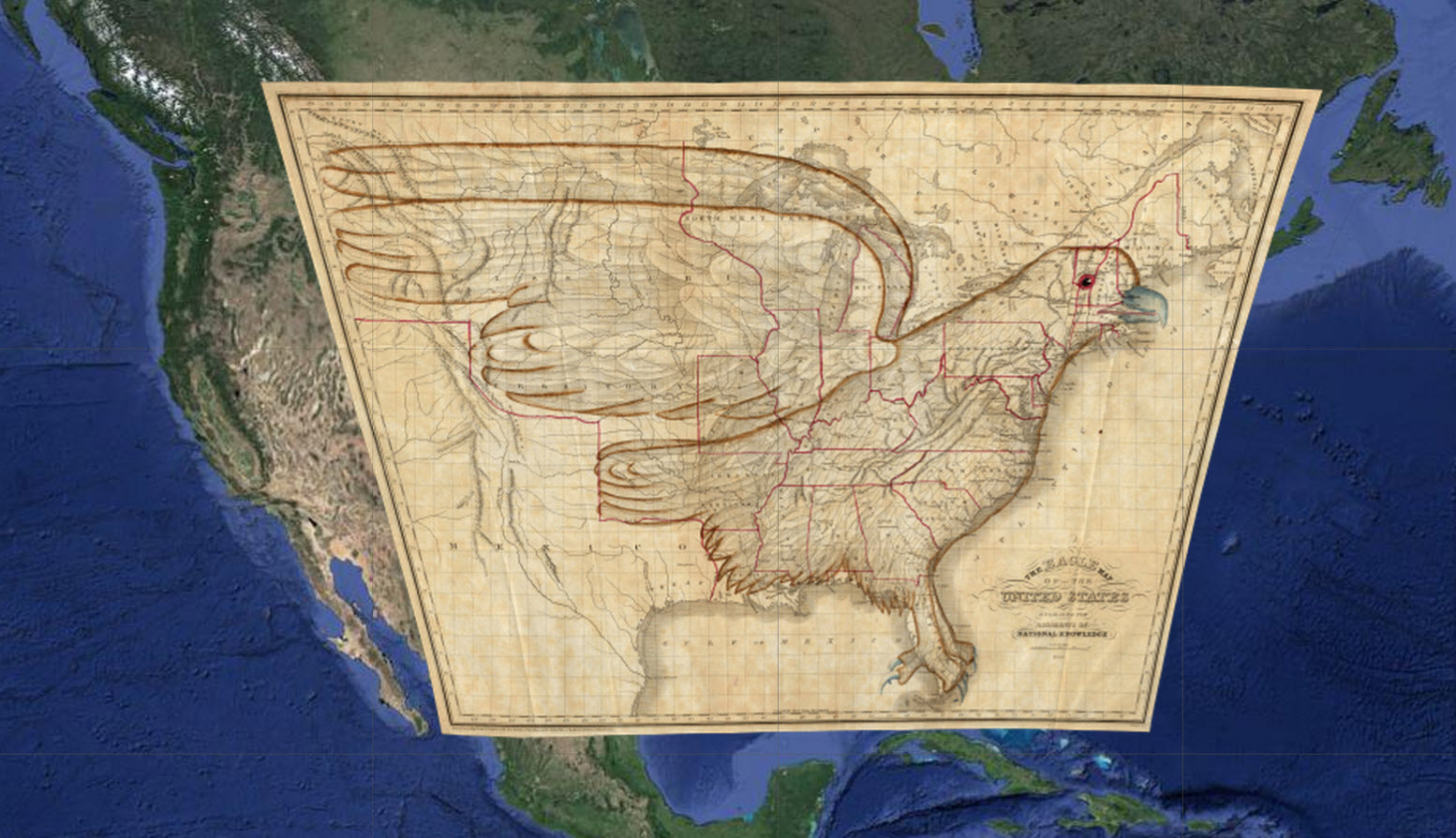
A rare eagle-themed map of the United States integrated into Google Maps.
These cutting-edge, immersive uses of map technology and photography are all well and good, but the David Rumsey historical maps collection is bringing old-school cartography back to the table in a blast from the past. Using advanced software, a high-resolution document camera
and historical maps, this project integrates a curated selection of 150 maps from the 1680s to the 1930s into incredibly detailed overlays on Google Maps. Each of the maps also includes brief annotations that describe notable features of and facts about each document.
In addition to being fascinating in and of itself, this project provides unique and interactive visual illustrations of historical views of the world. The old maps show how technologies and techniques in cartography have advanced over the last 300 years, and also how the world has changed in the time since they were drawn. Watching the hand-drawn maps load over top of satellite modern cities gives a really interesting perspective on global development and technological progress. These maps would be a great teaching tool to encourage historical thinking and analysis.
Additional Resources
- The Home page of the project
- About The David Rumsey Cartography Collection Google Maps Project
- Old Maps Online: a more extensive online archive of non-integrated maps